Memories
I recently asked the GPTA Board members to think of a special memory they have of the Great Plains. It may have been something related to the trail itself or just a scene that stays in their mind with the Great Plains as the backdrop. The results were like a Great Plains sunset – spectacular! Here they are…broken into several “episodes.”
From Founder Steve Myers
“Possibility”
Thru-hikers are fond of talking about “trail magic.” It can be defined as something that comes your way as an unexpected treat. Not surprisingly for weary hikers, it often takes the form of shelter, food, or beverage.
Some of my fondest memories of the early days of scouting the trail can only be described as trail magic, but in this case, it wasn’t food or drink, but something else – possibility.
The year was 2011. The GPT was mostly an idea in my head. Even GPTA was not yet officially formed. I was on summer break from teaching fifth grade in Colorado, and I carved out a week or ten days to do some scouting in western Nebraska. To be honest, I hadn’t even seen the country between Scottsbluff and the Black Hills yet. I had a rough idea of it, but nothing more.
Agate Fossil Beds National Monument and the rugged back roads through the pines from there to Fort Robinson were my first treats. I was excited to find three miles of rail trail (the White River Trail) from Fort Robinson into the town of Crawford.
Possibility was a word that sprang up in my mind.
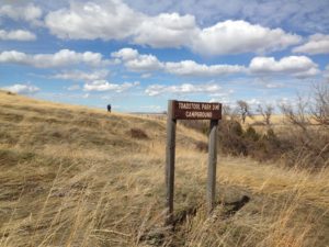
North of Crawford I was delighted to find the broken badlands of Nebraska which, again, despite being a student of the Great Plains, I didn’t know existed. Those badlands led to the Hudson-Meng Bison Bonebed – a research station run by the National Forest Service. I met rangers there who were enthusiastic about the GPT and immediately suggested I hike the Bison Trail, which led from Hudson -Meng to Toadstool Geologic Park.
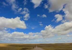
I can hardly describe what a joy it was to hike that trail for the first time. It is one of the most unique hikes you can take anywhere, and I saw possibility everywhere I looked. I camped that night at Toadstool and couldn’t believe what luck I was having – Trail Magic indeed!
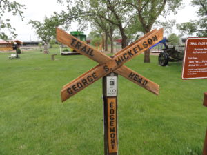
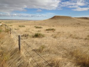
My next task was to connect Toadstool with Edgemont, SD which I knew was the southern terminus of the Mickelson Trail. It looked like for a hiker, it would be two very long days. Although the area is part of the Oglala National Grassland, much of it is privately owned, but there are some significant patches of public land. Having spotted a decent sized swath of public land about half way to Edgemont, I went to take a look at it. The area was definitely exposed, but was also hilly enough to offer some reasonable campsites, and the views were incredible!
The next day I drove into Edgemont and parked at the edge of town where there is a small city park and a sign that indicates “Mile 0.0” of the Mickelson Trail. I stared at the sign. A week prior, if you would’ve asked me, I would’ve said that the Great Plains Trail was a fantasy – an idea to play around with for a while, but ultimately . . . impossible.
I had just passed through some of the most beautiful scenery I had yet seen in the Great Plains. I had learned of at least six miles of real trail and successfully connected to a known trail system that could bring someone all the way through the Black Hills.
In that moment, staring at that sign, for the first time I thought, “No, this is actually possible.”